
Aquifer maps to boost water service delivery in Northern Cape
The Northern Cape province’s town of De Aar will become one of the very few in South Africa to drill and pump its boreholes strategically using scientific maps of underground aquifers. Harrison Pienaar, an aquifer expert at the CSIR, is calling on all South African waterboards, mayors, municipal managers and communities to conduct cost-effective groundwater surveys, ensuring compliance with the national directive to diversify municipal water supply.
Like the rest of the Northern Cape (NC), the parched and sunbaked town of De Aar in the Emthanjeni Local Municipality relies almost entirely on groundwater.
“Remember that surface water like dams or rivers are not in abundance there, because it is a semi-arid area,” says Pienaar, who leads smart water use studies at the CSIR Water Research Centre.
Some rain does fall; however, most seeps into the earth to recharge its underground water channels.
“When you have, say, five or six aquifer systems next to one another, some of these are horizontally linked and some are vertically linked,” Pienaar explains. “We need to study the relationship between these aquifer systems and their characteristics to understand which one will run dry and when, if they are all pumped for water at a certain rate.”
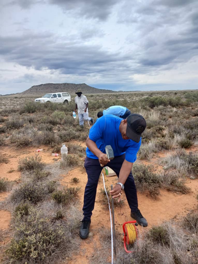
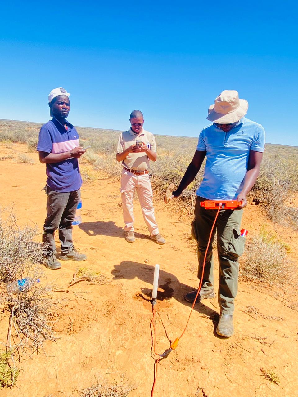
Over the past two years, local farmers and municipal officials hosted Pienaar and a team from the CSIR, the University of the Western Cape and the NC branch of the Department of Water and Sanitation (DWS) as they worked to map the aquifer systems below the surface. Often working day and night, they pinpointed the location, extent and thickness of groundwater channels and measured the quality of groundwater in terms of acidity, flow, temperature and potential harmful contaminants.
The researchers shared the outcomes and recommendations of this hydrogeophysical survey directly with the South African Local Government Association (SALGA) in the Northern Cape.
Pienaar says one of the immediate goals is to enable the municipality to better manage aquifer recharge (refilling from rainfall), as this will lead to better decisions on groundwater usage, monitoring and management. He says municipal managers can use the aquifer maps to schedule and switch borehole pumping in a way that will not deplete aquifers during, for instance, the dry season.
At the same time, the water quality data they have provided can inform water treatment measures that will ensure sustainable, clean and safe drinking water for their communities.
Unfortunately, says Pienaar, despite enough groundwater being available to supply its citizens, most municipalities in South Africa are not yet using cost-effective hydrogeophysical technologies, systems approaches or catchment-wide studies for groundwater allocation and management.
“Groundwater is not being looked at strategically,” says Pienaar, emphasising that the result is ultimately poor service delivery.
“It's just a shame when you drive through small towns in South Africa and people don't get even the most basic of services. As researchers, we come from the very same communities, so it hits home when we see people who don’t get services.”
To make matters worse, he says, South Africa is now over-reliant on surface water consumption, with the DWS urging diversification of water sources as a national imperative.
But it is not just a matter of drilling boreholes. “We need to consider the strategic points that we can point out to municipalities through these studies, to make sure that there's meaningful supply of water to the population that they serve,” says Pienaar.
He says it is time to adopt newer, faster and cheaper hydrogeophysical methods to study aquifer systems because traditional approaches are invasive and expensive.
“The old approach involved drilling and taking soil samples from the site, which can disturb the study site, cost too much time or money, or expose researchers and people to harmful chemicals and contaminants,” says Pienaar, adding that these methods cover only small, localised areas, rather than the large-scale underground maps required by municipalities.
In De Aar, scientific support from the CSIR and partners is ongoing, and SALGA expressed gratitude to Pienaar following his detailed presentation in December 2024 on the survey results and other smart technologies that will ensure efficient groundwater management and service delivery in the region.
Pienaar says successes in De Aar have led to another similar project approach for Lepelle Northern Water (a Limpopo-based waterboard) as part of its systems approach to water management.
“I want to urge other municipal managers, including waterboards, to equally consider strategic mapping and characterisation of aquifers to unlock the potential of groundwater as an important source of water supply,” says Pienaar. “This will reduce our overreliance on surface water, which is already overstressed due to increasing water use demands.”
This research forms part of a collaborative study between the CSIR, the University of the Western Cape and the DWS and it is co-funded by the DWS. It addresses SDG 6, SDG 11 and SDG 13.