Human settlement monitoring with satellite imagery
Another 7.8 million people will be living in South African cities in 2030 and a further 6 million by 2050. Major cities and metropolitan areas face significant challenges including population influx from rural areas, the expansion of formal and informal settlements, and provision of services (electricity and water). Accurate characterization and frequent monitoring of the urban environments and peri-urban boundaries, and various indicators of socio-economic metrics can be derived from very high resolution satellite and airborne imagery. The CSIR-Meraka’s Remote Sensing Research Unit has been developing technologies for human settlement mapping in collaboration with CSIR - Built Environment, National GeoSpatial Information and various metro’s.
Our research has the following focus areas:
- Settlement classification based on textural features and machine learning
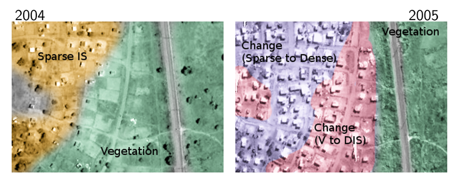
- Change detection between two dates based on texture features
- Continuous change detection using a time series of Landsat or Sentinel2 imagery
- Automated individual dwelling extraction based on object morphology, template matching and machine learning.
Our methods and outputs are used to:
- Monitor urban development in line with spatial development policies
- Track land use change along urban fridges
- Monitor increases in backyard shacks and dwelling densification in formal and informal settlement
- Derive geospatial intelligence for business insights and planning of services


